Urban Microclimate
UWG: urban design software development
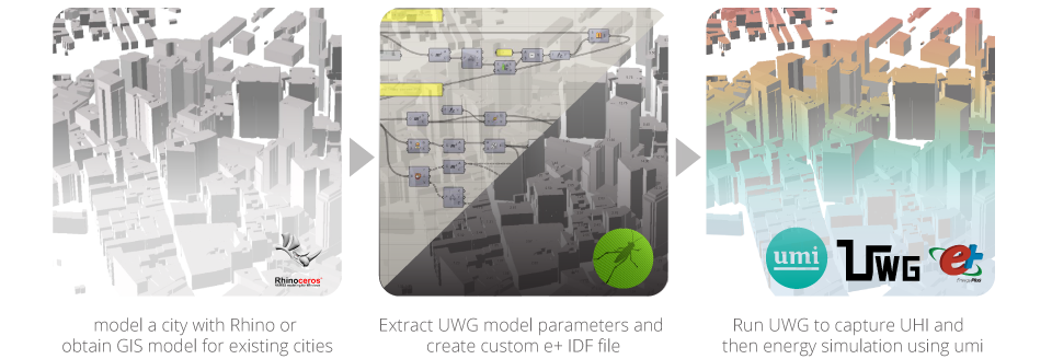
An optimization tool is currently being developed to suggest city-specific advice to minimize energy use and increase thermal comfort by controlling urban heat island effect [UHI].
UWG is appropriate for design tool for the following reasons:
- Robustness
- The model works for different weather stations and for all weather. This is extremely important for making a design tool because data is not always available for a site that captures climate conditions upwind of the city. It has been proven to work for variety of weather conditions including rainy, dry/cloudy, and dry/clear
- Versatility
- The output is a morphed weather file [epw] that is compatible with many building performance simulation programs
- Reliability
- The simulated results are comparable to a more computationally expensive mesoscale atmospheric model yet computationally efficient. However, simplifications and assumptions of the model prevent it from capturing very site-specific microclimate effects
Vision: Urban Planning + Energy Modeling with UHI
UWG can estimate the effects of urban morphology, geometry, and surface materials on temperature and energy consumption. This enables urban designers to parametrically test built densities and vegetation for masterplanning. Urban planners can advocate zoning regulations such as building height and land use as well as policies for traffic intensity and cool roof with energy and thermal implications of these interventions.
The workflow is integrated in Rhinoceros, a CAD-based modeling environment used by urban designers and architects.

Key Design + Planning Strategies to Improve Thermal Comfort and Energy Use
As UWG requires over 50 parameters, sensitivity analyses are performed to identify the most important parameters and reduce the number of user inputs. The goal is to remove meteorological variables from user input [i.e. advanced setting] as well as analyze effects of key design and planning strategies on reducing energy use and thermal discomfort.
An earlier study for Toulouse and Basel [mild climates] has shown that vertical to horizontal built ratio, horizontal building density, and vegetation are most sensitive. These results suggest UWG's applicability for design and planning tool. Additional study for Singapore [tropical] and Boston, MA are conducted to determine the most effective design strategies for each climate. The sensitivity analysis is detailed in the CENSAM poster .
Integral Component of the Family of Design Tools
A number of simulation tools have been developed at MIT. The presented software will be available as a stand-alone tool and a plug-in for umi to expand its capabilities to parametrically test urban design strategies as well as capture urban heat island effect for more realistic energy use estimations.
